Global ICESat-2 Nearshore Coastal Bathymetry Data Product Earn’s Editor Highlight Recognition
Congratulations to Dr. Lori Magruder’s collaborative team from the Center for Space Research, Oregon State University, and NASA on their recent paper, “Analysis and Accuracy Assessment of a New Global Nearshore ICESat-2 Bathymetric Data Product,” published in the August 2025 issue of AGU’s *Earth and Space Science* and selected as an Editor’s Highlight on eos.org.
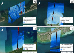
This recognition spotlights their new global ICESat-2 nearshore coastal bathymetric data product, ATL24, that will provide free, easy-to-access, and ready-to-use measurements for the world’s shallow coastal waters.
Citation: Parrish, C. E., Magruder, L. A., Perry, J., Holwill, M., Swinski, J. P., & Kief, K. (2025). *Analysis and accuracy assessment of a new global nearshore ICESat-2 bathymetric data product.* Earth and Space Science, 12, e2025EA004391. [https://doi.org/10.1029/2025EA004391](https://doi.org/10.1029/2025EA004391)
Source: [https://eos.org/editor-highlights/nasa-mission-creates-a-new-global-coastal-bathymetry-product](https://eos.org/editor-highlights/nasa-mission-creates-a-new-global-coastal-bathymetry-product)