Radar

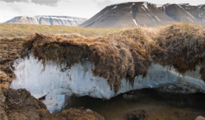
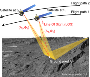
UT Radar Interferometry Group (led by Ann Chen) uses Interferometric Synthetic Aperture Radar (InSAR) techniques to measure up to millimeter-sized changes on Earth from imaging radar satellites orbiting 800 km or more above. Our goal is to diversify the use of InSAR for observing the dynamics of Earth systems. Our strength is the development of new algorithms using advanced signal processing and high-performance computing to process large volumes of InSAR data corrupted by noise. We investigate how these radar measurements can be related to properties of the earth surface and subsurface for geoscience studies in traditional crustal deformation applications such as imaging earthquakes, and volcanic activities, as well as new Earth system science applications such as the analysis of the atmosphere, biosphere, cryosphere, and hydrosphere, along with their mutual interactions.